Annotations
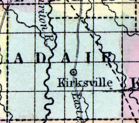
ADAIR COUNTY, in the northern part of Missouri, and traversed by Chariton river. Area --- square miles. Courts are held at Kirksville. Pop.,in 1850, 2,342. (Fanning's, 1853)
ADAIR, a county in N. N. E. part of Missouri, has an area of 570 square miles. It is intersected by Chariton river and by the North Fork of Salt river. The surface presents no great elevations ; the soil is generally fertile, adapted to grain and grass. It produced in 1850, 141,370 bushels of Indian corn; 5801 of wheat; 11,157 of oats, and 32,605 of butter. Organized about the year 1840. Capital, Kirksville. Population, free 2298, slaves 53 ; total 2351. (Baldwin & Thomas, A New and Complete Gazetteer of the United States ... 1854)
Demographic
Total Population 1850
2342
Total Population 1860
8531
Free Black Population 1860
9
Free Black Population 1850
8
Enslaved Population 1860
86
Enslaved Population 1850
51
Political
Presidential Election Result 1848
Democrat
Presidential Election Result 1852
Democrat
Presidential Election Result 1856
Democrat
Presidential Election Result 1860
Douglas Democrat
Presidential Election Result 1864
Unconditional Union (1864)
Geographic
Latitude
40.190666
Longitude
-92.603592
Type
County
County
Adair
State
Missouri

