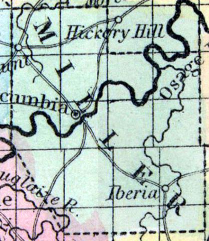
MILLER COUNTY, situated in the central part of Missouri, and traversed by Osage river. Area, 555 square miles. Seat of justice, Tuscumbia. Pop. in 1840, 2,282; in 1850, 3,834. (Fanning's, 1853)
MILLER, a county in the S. central part of Missouri, has an area of 570 square miles. It is intersected by Osage river, and also drained by Auglaize river and Tavern creek. The surface is uneven, and in some parts broken ; the soil is generally poor, excepting on the margins of the streams. The county is well timbered with valuable wood, including walnut and sugar maple. Indian corn, wheat, oats, hay, cattle, and swine are the staples. In 1850 the county produced 144,994 bushels of corn; 14,724 of wheat; 34,603 of oats, and 182 tons of hay. The Osage river is navigable in high stages of water, that is usually 3 or 4 months of the year. Named in honor of John Miller, former governor of Missouri. Capital, Tuscumbia. Population, 3834, of whom 3645 were free, and 189, slaves. (Baldwin & Thomas, A New and Complete Gazetteer of the United States ... 1854)

