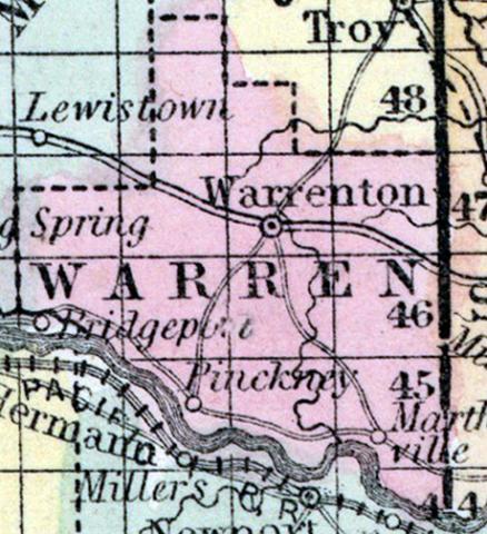
WARREN COUNTY, situated in the east part of Missouri, with Missouri river on the south. Area, 350 square miles. Seat of justice, Warrenton. Pop. in 1840, 4,253; in 1850, 5,860. (Fanning's, 1853) Warren, a county in the E. part of Missouri, contains about 400 square miles. The Missouri river forms the boundary on the S. S. W., and the county is drained by Peruque, Massies, Smith's, Charette, and Bear creeks. A range of bluffs extends along the river, leaving a fertile bottom, from 1 to 5 miles in width. Indian corn, wheat, oats, tobacco, and butter are the staples. In 1850 this county produced 365,496 bushels of corn; 35,732 of wheat; 52,831 of oats ; 431,000 pounds of tobacco, and 65,907 of butter. It contained 20 churches. Limestone and sandstone, suitable for building, are abundant. Capital, Warrenton. Population, 5868 ; of whom 4925 were free, and 935, slaves. (Baldwin & Thomas, A New and Complete Gazetteer of the United States ... 1854)
Annotations
Total Population 1840
4253
Total Population 1850
5868
Total Population 1860
8839
Free Black Population 1860
7
Free Black Population 1850
4
Free Black Population 1840
2
Enslaved Population 1860
1034
Enslaved Population 1850
935
Enslaved Population 1840
696
Presidential Election Result 1840
Democrat
Presidential Election Result 1848
Whig
Presidential Election Result 1856
American (Know Nothing)
Presidential Election Result 1860
Douglas Democrat
Presidential Election Result 1864
Unconditional Union (1864)
Latitude
38.761902
Longitude
-91.159306
Waterways
Yes
Type
County
State
Missouri

