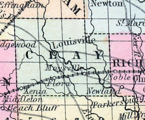
CLAY COUNTY, III. Situated in the s. E. part of the state. It contains 475 sq. ms. Surface level, soil fertile. Drained by Little Wabash r. Capital, Lewisville. There were in 1840, neat cattle 9,033, sheep 2,483, swine 12,033; wheat 4,050 bush. produced, rye 430, Ind. com 144,189, oats 18,850, potatoes 8,770, tobacco 2,430 pounds, cotton 1,396, sugar 2,772 ; 5 stores, cap. $2,750; 2 tanneries, 6 grist m.. 4 saw m. Cap. in manufac. $12,880. 6 sch. 134 scholars. Pop. 3.228. (Haskell's Complete Descriptive and Statistical Gazetteer of the the United States...,1840)
CLAY COUNTY, situated toward the southeast part of Illinois. Area, 475 square miles. Seat of justice, Lewisville. Pop. in 1830, 755; in 1840, 3,228; in 1850, 4,289. (Fanning's, 1853)
CLAY a county in the S. E. part of Illinois, has an area of 440 square miles. It is intersected by the Little Wabash river, and also drained by Elm creek. The slope of the county is toward the S. E.; the surface is undulating, or nearly level; and the soil is fertile. The county consists partly of prairie, and is partly covered by forests. Indian corn, oats, potatoes, and pork are the staples. In 1850 it produced 245,675 bushels of corn; 38,315 of oats, and 320 tons of hay. It contained 3 churches, and 480 pupils attending public' schools. Capital, Maysville. Population, 4289. (Baldwin's New and Complete Gazetteer of the United States..., 1854)

