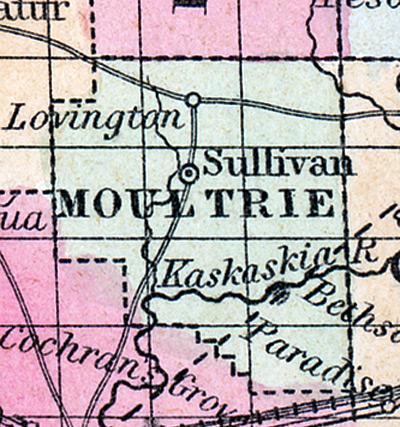
MOULTRIE COUNTY, situated in the central part of Illinois. Watered by Kaskaskia river. Pop. in 1850, 3,234. (Fanning's, 1853)
MOULTRIE, a county in the S. E. central part of Illinois, has an area of 320 square miles. It is intersected by Kaskaskia river. The county consists partly of prairie and partly of timbered land; the soil is fertile, adapted to Indian corn, grass, &c. In 1850 the county produced 373,630 bushels of Indian corn; 6148 of wheat; 60,040 of oats, and 15,368 pounds of wool. It contained 7 churches, and 380 pupils attending public schools. The Alton and Terre Haute railroad passes along the southern border. Capitol, Auburn. Population, 3234. (Baldwin's New and Complete Gazetteer of the United States..., 1854)
MOULTRIE COUNTY Is situated in the south-cast central part of the state and has an area of 320 square miles. It is intersected by Kaskaskia river. The county consists partly of prairie and partly of timbered land, the soil is fertile and adapted to com, grass, etc. It contains a number of fine churches, and has over 600 pupils attending public schools. The Terre Haute and Alton railroad passes along the southern border. Capital, Sullivan. Population, about 7,000. (Hawes' Illinois State Gazetteer...,1859)

