All States // Missouri // Illinois // Iowa
Displaying 1 - 50 of 1183
State:
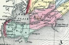
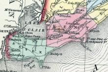
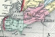
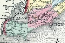
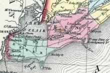
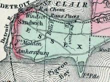
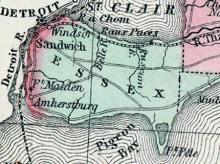
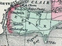
AMHERSTBURG. A garrison Town, in the township of Malden, in the county of Essex: sixteen miles from Sandwich, on the Detroit River. It was commenced in the year 1798, soon after the evacuation of Detroit. The situation is good, but most of the streets are rather narrow.
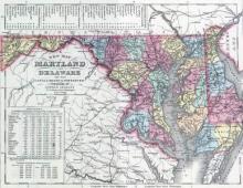
ANNAPOLIS CITY, capital of Maryland, and seat of justice of Anne Arundel county, is situated on the south west bank of Severn river, three miles from its entrance into Chesapeake bay, 20 miles southeast of Baltimore, and 40 miles from Washington. Though located favorably enough for commerce, on a good harbor, the tide of trade and prosperity is drawn too strongly toward Baltimore to allow it to flourish as vigorously as it otherwise might.
In Kent County, Canada West, founded in 1849. Home of fugitives, including William Parker, of Christiana fame.
CHATHAM. The County Town of the County of Kent; pleasantly and advantageously situated on the River Thames, at the junction of the townships of Chatham, Raleigh, Harwich, and Dover East; and at the entrance of McGregor's Creek into that river: the portion of it situated on the north shore of the river being called Chatham North.
COLCHESTER. A Township in the county of Essex; bounded on the north by the townships of Maidstone and Sandwich; on the west by Anderdon and Malden; on the south by Lake Erie; and on the east by Gosfield. It contains 21,530 acres, of which 5124 are under cultivation. About half the township is wet land, and requires considerable draining; the remainder is mostly good land. Timber, maple, beech, elm, oak, black walnut, butternut, chestnut, &c.
DAWN. A township in the Western District; is bounded on the east by the township of Zone, on the north by Enniskillen, on the west by Sombra, and on the south by Chatham and Camden west. In Dawn 16,339 acres are taken up, 3,320 of which are under cultivation. This is a fine township, containing excellent land ; the soil is generally rich, and the timber the best kinds of hardwood— maple, black walnut, beech, elm, white oak, &c.
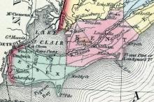
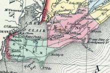
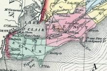
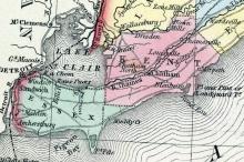
ESSEX. A County in the Western District; comprises the townships of Anderdon, Colchester, Gosfield, Maidstone, Mersea, Malden, Rochester, and SandwichIt returns a member to the House of Assembly. (Smith's Canadian Gazetteer, 1849)
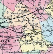
GALT. A Village in the township of Dumfries, prettily situated on the Grand River, in a valley surrounded by high hills; twenty-five miles from Hamilton, and eighteen from Brantford. It has very valuable water-power, by the employment of which, in milling and manufacturing, the place is fast rising into prosperity; and already begins to assume the appearance of a town.
GOSFIELD. A Township in the county of Essex; is bounded on the north by the townships of Rochester and Maidstone; on the west by Colchester ; on the south by Lake Erie ; and on the east by Mersea. In Gosfield 24,803 acres of land are taken up, of which 5,030 are under cultivation. About half the land in this township is wet, and requires considerable draining ; the remainder is mostly excellent land.
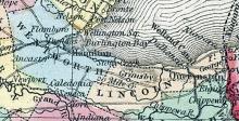
HAMILTON. The District Town of the Gore District, in the township of Barton and county of Wentworth; is situated in an extensive valley on the south side of Burlington Bay, at its western extremity. The town was laid out in the year 1813, by a Mr. Hamilton, from whom it derived its name. On account of the swamp in the vicinity of the bay, the principal part of the town has been placed about a mile back from the bay, on a gently rising ground.
KENT. A County in the Western District. It comprises the townships of Bosanquet, Brooke, Camden, Chatham, Dawn, East Dover, West Dover, Enniskillen, Harwich, Howard, Moore, Orford, Plympton, Raleigh, Romney, Sarnia, Sombra, East Tilbury, Warwick and Zone. It returns a member to the House of Assembly. (Smith's Canadian Gazetteer, 1849)
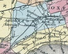
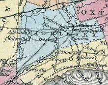
LONDON. The District Town of the London District, situated in the township of London, on the River Thames, eighty-five miles from Hamilton, twenty-six from Port Stanley, and seventeen from St. Thomas. The town was laid out in 1826 by the Crown, on land reserved by Governor Simcoe; it returned a member in 1836, and was incorporated in 1840.
From Hayward's 1854 Gazetteer: "This state became a territorial member of the Federal Union in the year 1803, under peculiar circumstances.
MERSEA. A Township in the County of Essex; is bounded on the north by the township of Tilbury West; on the West by Gosfield; on the south by Lake Erie; andon the east by Romney. In Mersea 20,574 acres are taken up, of which 2,593 are under cultivation. An extensive, triangular-shaped point of land, embracing about one-third of the township, called “Point Pelé,” runs out into the lake. This is principally sand and marsh, and incapable of being cultivated.
MISSOURI, (i.e. the "Mud river,") the longest tributary stream in the world, has its source in the Rocky Mountains, lat. 45° N., Ion. 110° 30' W. The springs which give rise to this river are not more than a mile from the head waters of the Columbia, which flows W. to the Pacific ocean. The first 500 miles of its course to the Great Falls is nearly N. ; then inflecting E. N. E., it reaches its extreme northern bend at the junction of White Earth river, lat. 48° 20' N.
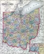
From Hayward's 1854 Gazetteer: "This state has heretofore been classed among the North-west States of the American Union; but the vast accumulation of territory lying still farther west and north has left Ohio more properly among the Middle States, on the Atlantic side of the continent: indeed, her relative position, considered in regard to the present north-western possessions of the United States, is actually that of one of the Eastern States of this republic. Marietta, the olde
PELE, POINT. A Point of Land, part of the township of Mersea, which runs out into Lake Erie. (Smith's Canadian Gazetteer, 1849)
SANDWICH. The District Town of the Western District, beautifully situated on the Detroit River, about two miles below Detroit, and nine miles below Lake St. Clair. The town is neatly laid out; and, being an old settlement, with fine old orchards, and well kept flower gardens, has very much the appearance of an English country town. It is built on a gravelly soil, on a gently sloping bank, a short distance from the river, which is here about a mile wide.
ST. CATHARINES. A Town in the township of Grantham, situated on the Welland Canal, thirty-six miles from Hamilton, and twelve miles from Niagara. The town is beautifully situated, having a fine view for a considerable distance of the Welland Canal and surrounding country.
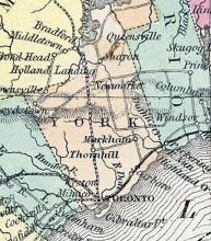
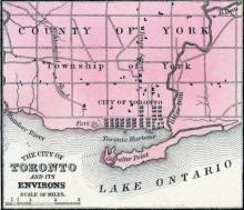
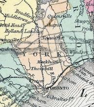
HOME DISTRICT. Consists of the County of York and the City of Toronto. The county of York is divided into four ridings, each returning one member to the Legislative Assembly. The north riding comprises the townships of Brock, North Gwillimbury, East Gwillimbury, Georgina, Mara, Reach, Rama, Scott, Thorah, Uxbridge and Whitchurch. The south riding comprises the townships of Etobicoke, King, Vaughan, and York, and for the purposes of registration of titles only, the city of Toronto.
TORONTO. The District Town of the Home District, situated in the south-east of the township of York, on a bay of Lake Ontario. The neighbourhood first commenced settling about fifty years ago; but for some years it advanced very slowly. In 1799 the whole district, which then included a large portion of the surrounding country, which has since been formed into separate districts, contained only 224 inhabitants.
WINDSOR. A Village in the township of Sandwich, pleasantly situated on the Detroit River, opposite the city of Detroit, in Michigan. It was laid out in 1834, and is a place of considerable business. Two steam ferry-boats ply constantly between this place and Detroit. The situation is healthy, the town being built on a high bank, from thirty to forty feet above the river, which is here about a mile in width.
HOME DISTRICT. Consists of the County of York and the City of Toronto. The county of York is divided into four ridings, each returning one member to the Legislative Assembly. The north riding comprises the townships of Brock, North Gwillimbury, East Gwillimbury, Georgina, Mara, Reach, Rama, Scott, Thorah, Uxbridge and Whitchurch. The south riding comprises the townships of Etobicoke, King, Vaughan, and York, and for the purposes of registration of titles only, the city of Toronto.
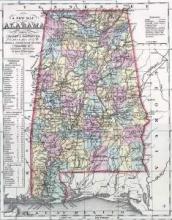
State: Alabama
Huntsville, Aa., shire town of Madison co. About 180 miles N. by W. from Montgomery, and 150 N. by E. from Tuscaloosa. It is a neat and thriving place, situated in the northern part of the state, about 10 miles N.
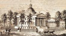
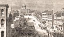
MONTGOMERY, city, seat of justice of Montgomery co., and the capital of the state of Alabama, having succeeded Tuscaloosa, as the seat of government, in 1847, has a central situation in Montgomery county, 220 miles northeast of Mobile, and 839 miles from Washington. It is the centre of an extensive trade in cotton, which is brought from the surrounding country to this point, the head of steamboat navigation on Alabama river. It contains the usual number of public buildings.
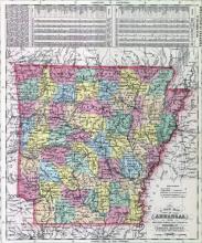
State: Arkansas
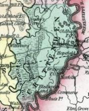
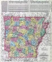
CRITTENDEN COUNTY, situated on the eastern boundary of Arkansas, between Mississippi and St. Francis rivers. Area, 2,100 square miles. Face of the country generally level; soil fertile, and in many parts subject to annual inundation. Seat of justice, Marion. Pop. in 1830, 1,272; in 1840, 1,501; in 1850, 2,648.
Fanning's Illustrated Gazetteer of the United States.... (New York: Phelps, Fanning & Co., 1853), 96.
Ouachita County, As., c. h. at Camden. Southern part. The Ouachita flows through it from N. to S.
John Hayward, Gazetteer of the United States of America… (Philadelphia: James L. Gihon, 1854), 509.
State: District Of Columbia
State: Delaware
DOVER, Dover Hundred, the capital of Del., and seat of justice of Kent co., is a borough on Jones' creek, 10 ms from its entrance into Delaware bay, 50 ms s. of Wilmington; from W. 120 ms. It is built on four principal streets, which, intersecting, form a square in the centre of the town. Here is an elegant statehouse, and several churches, banks, and other public buildings, are in the vicinity. The buildings are neat, and generally of brick.

