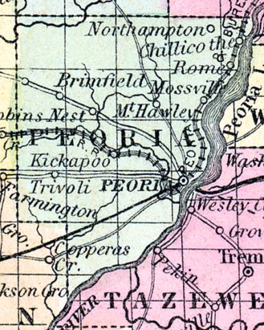
PEORIA COUNTY, situated toward the west part of Illinois, with Illinois river on the southeast. Area, 648 square miles. Seat of justice, Peoria. Pop. in 1840, 6,153; in 1850, 17,547. (Fanning's, 1853)
PEORIA COUNTY A county in the north-west central part of the state, has an area of 650 square miles. The Illinois river and Peoria lake form the south-east boundary. It is drained by Spoon river and by Hicapoo, Elbow and Copperas creeks. These streams are bordered with tracts of timber which are separated from one another by beautiful undulating prairies. The soil is uniformly and highly productive. Corn, wheat, oats, hay, pork and potatoes are the staples. It contains a large number of churches, several newspaper offices, and has over 4,000 pupils attending public schools. Valuable mines of stone coal have been opened in the county. The Illinois river is navigable for steamboats along the border. The county is intersected by the Peoria and Oquawka railroad. Organized in 1325, and named from the tribe of Indians who possessed the soil. Capital, Peoria. Population, 32,500. (Hawes' Illinois State Gazetteer...., 1859)

