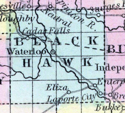
BLACK HAWK COUNTY, situated toward the northeast part of Iowa, and traversed by Cedar and Black Hawk rivers. Area, 625 square miles. Cedar Falls is the chief town. Pop in 1850, 135. (Fanning's, 1853)
BLACK HAWK, a new county in the N. E. central part of Iowa, has an area of 576 square miles. It is intersected by the Cedar river, which flows in a S. E. direction, dividing it into nearly equal parts. The prairies of this county are estimated to be more extensive than the timbered land. The soil produces Indian corn, wheat, oats, and potatoes. In 1850 there were raised 2150 bushels of Indian corn; 160 of wheat, and 235 tons of hay. This county is not yet fully organized. Population, 135. (Baldwin's New and Complete Gazetteer of the United States..., 1854)
BLACK HAWK COUNTY. This county, bearing the name of the illustrious chief, possesses some of the finest soil and timber land in Northern Iowa. It is in the same range with, and the third county from, Dubuque. The Cedar fork of the Iowa river passes diagonally in a south-easterly direction across the county. Cedar Falls is a town of considerable importance, and will become a large manufacturing place. At this, as well as several other points in the county, the best of water-power and eligible sites for mills and manufacturing establishments hold out inducements to capitalists, while the immense quantity of unentered land in the county calls loudly to the immigrating farmer. (Iowa As It Is in 1855; A Gazetteer for Citizens..., 1855)

