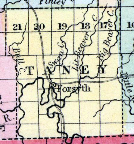
TANEY COUNTY, situated on the south boundary of Missouri, and traversed by White river and many of its tributaries. Area, 1,426 square miles. Seat of justice, Forsyth. Pop. in 1840, 2,264; in 1850, 4,373. (Fanning's, 1853)
TANEY, a county in the S. S. W. part of Missouri, bordering on Arkansas, has an area of 1540 square miles. It is intersected by White river, and also drained by James fork, and Bull, Swan, Beaver, and Long creeks, affluents of the White river. The surface is uneven and broken; the soil of the valleys is fertile. Indian corn, wheat, oats, hay, cattle, pork, and butter are the staples. The county is plentifully supplied with springs of good water. In 1860 it produced 301,116 bushels of corn; 11,557 of wheat; 38,826 of oats, and 78,585 pounds of' butter. The county was named in honor of Roger B. Taney, chief justice of the United States. Capital, Forsyth. Population, 4373; of whom 4274 were free, and 99, slaves. (Baldwin's New and Complete Gazetteer of the United States..., 1854)

