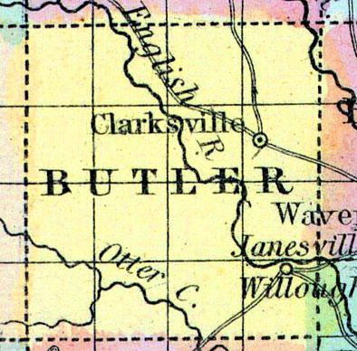
BUTLER, a new county in the N. K. central part of Iowa, has an area of 576 square miles. It is intersected by English river, and also drained by Pipe and Otter creeks. It contains extensive prairies, mostly uncultivated. This county is not included in the census of 1850. County seat not located. (Baldwin's New and Complete Gazetteer of the United States..., 1854)
BUTLER COUNTY Is in the third tier of counties from the northern boundary of the State, and the fourth west of the Mississippi River. It is bounded by Floyd on the north, Bremer and Blackhawk on the east, Grundy on the south and Franklin on the west. It was organized in 1854.
A portion of the county is quite level, the remainder would be termed rolling prairie, there is scarcely a hill in the county except now and then a few bluffs along the streams.
Prairie and timber are as well proportioned and distributed as in any county in this part of the State, and soil equal to any of the adjoining counties, well adapted to raising wheat, corn, etc., and some parts of the county cannot be surpassed for raising stock, and for dairy purposes.
The timber, consists of white burr and jack oaks, sugar maple, black walnut, hickory, elm, linn, etc.
There is an abundance of brick stone and brick clay. The principal streams are: first, the Shell Rock River which for beauty and its numerous mill sites cannot be surpassed in the west. It rises in Minnesota, and runs in a southeasterly direction through the eastern portion of the county, and empties into the Cedar River, a few miles above Cedar Falls. Within the county, on this stream, are now three flouring mills.
The second stream is called the West Fork of the Shell Rock, running nearly parallel with the Shell Rock through the centre of the county; next the Beaver, a smaller stream in the southern part of the county, upon which there are numerous mill sites.
There are sixteen townships in the county, to-wit: Albion, Butler, Beaver, Benezette, Cold-Water, Dayton, Fremont, Jackson, Jefferson, Monroe, Madison, Pittsford, Ripley, Shell Rock, Washington and West Point.
Joseph Hix and Robert T. Crowell were the first white settlers. They settled in 1850, near where the village of Clarksville has since been located. The DuBuque and Sioux City Railroad passes through the southern part of the county, and the Cedar Falls and Minnesota Road is being built through the north-east part of the county. (Hair's Iowa State Gazetteer..., 1865)

