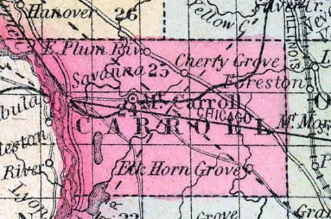
CARROLL COUNTY, situated on the westerly boundary of Illinois, on tho east side of Mississippi river. Area, 445 square miles. Seat of justice Mount Carroll. Pop. in 1840, 1,023; in 1850, 4,586. (Fanning's, 1853)
CARROLL COUNTY Is in the W.N.W. part of the state, and has an area of 416 square miles. The Mississippi forms its western boundary separating it from Iowa, and it is drained by Plum, Elkhorn, Otter and Rush creeks. The surface is undulating and diversified with prairies and tracts of timber, the former of which arc the most extensive. The soil is productive. Wheat, corn, oats, pork and butter are the staples. A considerable quantity of land has also been obtained in this county. The Racine & Mississippi railroad is located in this county, and is designed to connect Lake Michigan and the Mississippi, passing through Beloit, Freeport and terminating at Savannah. Capital, Mount Carroll. Population, 5,480. (Hawes' Illinois State Gazetteer..., 1859)

