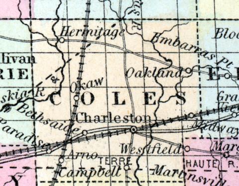
COLES COUNTY, situated in the eastern part of Illinois. Area, 1,248 square miles. Seat of justice, Charleston. Pop. in 1840, 9,616 ; in 1850, 9,335. (Fanning's, 1853)
COLES COUNTY Is located in the south-east central part of Illinois, and has an area of 880 square miles; it is intersected by the Kaskaskia and Embarras rivers, which flow nearly southward; the surface is rolling, and quite destitute of forests; a part of Grand Prairie is included in this county; the soil is very fertile. Indian corn, wheat, oats, hay, pork and butter, are the staples. The county is well supplied with churches, schools and newspaper offices, which fact is a sufficient guarantee of the intelligence and good sense of the people. The Chicago branch of the central railroad intersects the county. Named in honor of Edward Coles, second governor of Illinois. Capital, Charlestown. Population about 14,000. (Hawes' Illinois State Gazetteer...,1859)

