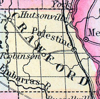
CRAWFORD COUNTY, situated on the westerly boundary of Illinois, with Wabash river on the east, and Embarrass river on the southwest. Area, 426 square miles. Face of the county variegated by hills and plains; soil productive. Seat of justice, Palestine. Pop. in 1820, 3,024 ; in 1830, 3,117 ; in 1840, 4,422 ; in 1850, 7,135. (Fanning's, 1853)
CRAWFORD a county in the E. S. E. part of Illinois, bordering on Indiana, has an area of 420 square miles. The Wabash river forms the eastern boundary, the Embarras river flows through the south-western part, and the N. fork of the latter flows along the western border. The surface presents a large proportion of prairie, the soil of which is good. Indian corn, wheat, oats, grass, cattle, and swine are the staples. In 1850 it produced 453,955 bushels of corn; 16,943 of wheat; 59,001 of oats, and 1411 tons of hay. It contained 7 churches, and 620 pupils attending public schools. The Wabash river is navigable along the border of the county. Named in honor of William H. Crawford, former secretary of the treasury. Capital, Palestine. Population, 7135. (Baldwin's New and Complete Gazetteer of the United States..., 1854)

