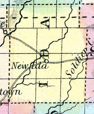
IDA, a new county in the W. N. W. part of Iowa, has an area of about 400 square miles. It is traversed by the Inyan Yanky. or Little Sioux river, an affluent of the Missouri. It is not included in the census of 1850. County seat not located. (Baldwin's New and Complete Gazetteer of the United States..., 1854)
IDA COUNTY Is in the fourth tier of counties south of the northern boundary of the State, and the second east of the Missouri River. It is bounded on the north by Cherokee county, on the east by Sac, on the south by Crawford and Monona, and on the west by Woodbury. It is one of the smaller counties, containing only twelve townships and 432 square miles. It is watered by the Maple River and its tributaries, which flow through the county from the northeast to the southwest corner. The bottom lands and adjacent prairies are considered extremely good for agricultural purposes, and were the first that were entered in the county. The DuBuque & Sioux City Railroad is located near the northern part of this county.
IDA, the county seat, is near the centre of the county on Maple River. (Hair's Iowa State Gazetteer..., 1865)

