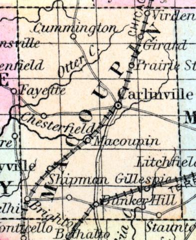
MACOUPIN COUNTY, situated toward the western boundary of Illinois. Area, 800 square miles. Face of the country level, and soil productive. Watered by Macoupin river. Seat of justice, Carlinville. Pop. in 1835, 5,554; in 1840, 7,826; in 1850, 12,355. (Fanning's, 1853)
MACOUPIN COUNTY Is situated in the west-south-west part of the state, and has an area of 800 square miles. It is drained by Macoupin, Otter and Cahokia creeks, from the first of which the name is derived. The surface is moderately uneven and soil fertile. Corn, wheat, oats, potatoes, pork and butter are the staples. It contains a large number of churches, and has over 2,600 pupils attending public schools. The county is intersected by the St Louis, Alton & Chicago and the Terre Haute & Alton railroads. In early days the county bore the name of Black Hawk Hunting Ground. Then over our beautiful prairies bounded the deer in fearless freedom and in countless numbers, untorn by the white man's hound and unscared by his murderous rifle, and through our forests prowled the sluggish bear, undisturbed in savage solitude. They subsisted on a root, called by the Indians "macopin," signifying "bear's root;" here we have the origin of the name of the county. It was organized in 1829, from portions of Greene, Sangamon and Madison counties, and in that spring the first county court, consisting of three persons, held its first session in a private dwelling. The appearance of the county, the value and condition of the soil then differed from the soil and county now, as widely as a valley differs from a mountain. One of the first white men who settled in the county was named Hall, whose descendants are among the most worthy citizens of the county. Capital, Carlinsville. Population, about 19,600. County Judge, Lewis Solomon. Sheriff, Milton McClure. (Hawes' Illinois State Gazetteer...,1859)

