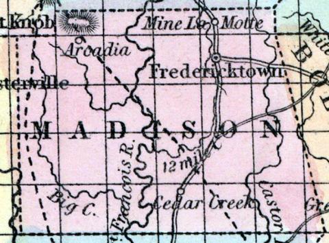
MADISON COUNTY, situated in the southeasterly part of Missouri. Area, 780 square miles. Seat of justice, Fredericktown. Pop. in 1830, 2,371; in 1840, 3,395; in 1850, 6,003. (Fanning's, 1853)
MADISON, a county in the S. E. part of Missouri, has an area of about 900 square miles. It is intersected by the St. Francis river, and Castor creek, flowing from N. to S., and also drained by More's and Big creeks. The soil is generally thin. Indian corn, wheat, oats, hay, and butter are the staples of agriculture. Lead is the chief article of export. In 1850 the county produced 266,690 bushels of corn; 11,439 of wheat; 39,505 of oats, and 540 tons of hay. It contained 4 churches. Limestone and sandstone are the principal rocks of the county. Iron and lead are abundant, and a small quantity of copper is found in connection with the lead. The La Motte mine, in the N. part of the county, has yielded about 1,000,000 pounds of lead in a single year. In the N. W. part is a remarkable eminence, called Pilot Knob, which is covered with the micaceous oxide of iron. Capital, Fredericktown. Population, 6003; of whom 5307 were free, and 696, slaves. (Baldwin & Thomas, A New and Complete Gazetteer of the United States ... 1854)

