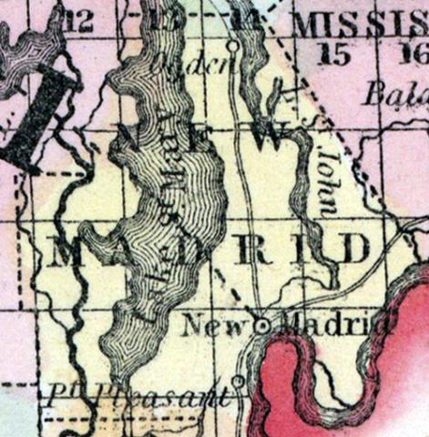
NEW MADRID COUNTY, Mo., c. h. at New Madrid. Bounded N. and N. E. by Scott and Mississippi counties E. and S. by the Mississippi River, separating it from Kentucky and W. by Dunklin co. The surface is level, and the soil, in parts not liable to inundation, is fertile. (Gazetteer of the United States of America, 1854)
NEW MADRID, a county near the S.E. extremity of Missouri, bordering on the Mississippi river, which separates it from Tennessee and Kentucky, has an area of 880 square miles. The Whitewater, an affluent of the St. Francis, flows along the W. border. The surface is an alluvial plain, which does not contain a rock of any description. The soil is highly productive, excepting the parts that are overflowed. Indian corn is the great staple. The county is well timbered with the oak, hickory, and cypress. In 1850 the county produced 586,260 bushels of corn. It contained 8 churches and 1 newspaper office; 332 pupils attending public schools and 100 attending other schools. This county was severely injured by the earthquakes of 1811 and 1812, by which about half of its area was sunk several feet and covered with water. The shocks were attended with loud explosions; and chasms were opened in the ground, from which volumes of water and steam were discharged. Islands in the Mississippi were sunk; the current of the river was driven back for several hours by the elevation of its bed, and overflowed the adjacent land. One of the lakes formed at this time is said to be nearly 60 miles long, and several miles wide. The legislature of Missouri, during the session of 1850 and '51, made an appropriation for the purpose of reclaiming the sunken lands of this and the adjoining counties. Capital, New Madrid. Population, 5541, of whom 4000 were free, and 1481, slaves. (Baldwin & Thomas, A New and Complete Gazetteer of the United States ... 1854)

