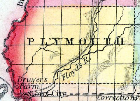
PLYMOUTH COUNTY Plymouth County was organized in 1858. It is in the western tier of counties, and the third from the northern boundary of the State. It is bounded on the north by Sioux County, on the east by Cherokee, on the south by Woodbury. It is watered by the Floyd River and its tributaries, which pass through the centre of the county in a south-westerly direction. The west fork of the Sioux River drains the southeastern corner of the county. The soil is good but is of lighter color than usual on prairies, and on some of the higher lands it has a shorter and thinner growth of grass, but such are found to be superior wheat lands. Large crops of both wheat and corn, the growth of the best native grasses, and the good condition of the cattle and horses are all indications of agricultural resources that will be eventually developed in this county. The want of timber is the greatest obstacle to settlement. The DuBuque and Sioux City Railroad line is located through six townships of this county.
MELBOURNE, the county seat, is in the southern part of the county on Floyd River. (Hair's Iowa State Gazetteer..., 1865)
Annotations
Total Population 1860
148
Free Black Population 1860
0
Presidential Election Result 1860
Republican
Presidential Election Result 1864
Unconditional Union (1864)
Latitude
42.737585
Longitude
-96.215864
Railroads
Yes
Type
County
County
Plymouth
State
Iowa

