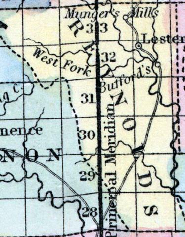
REYNOLDS COUNTY, situated toward the southeast part of Missouri. Area, --------- square miles. Seat of justice, Alamode. Pop. in 1850, 1,849. (Fanning's, 1853)
REYNOLDS, a new county in the 8. E. part of Missouri, has an area of 660 square miles. It is drained by the head streams of Big Black river. The surface is uneven, and partly covered with forests of pine. Indian corn, wheat, oats, cattle, and butter and the staples. In 1850 this county produced 75,925 bushels of corn; 2882 of wheat; 7551 of oats, and 10,900 pounds of butter. It contained 2 churches, and 465 pupils attending public schools. Named in honor of Thomas Reynolds, a former governor of Missouri. Capital, Lesterville. Population, 1849; of whom 1824 were free,and 25, slaves. (Baldwin & Thomas, A New and Complete Gazetteer of the United States ... 1854)
REYNOLDS COUNTY. This county is situated in the southeastern part of the State, is bounded on the north by Iron and Dent, on the south by Carter and Shannon, on the east by Iron and Wayne, and on the west by Dent, Shannon, and Carter Counties.
Reynolds County was named in honor of Thomas Reynolds, a former Governor of the State, and in 1850 contained a population of 1849; in 1856, 2399; and in 1860, 3320.
The face of the country is rough and broken, and in some portions the scenery is wild and beautiful. The county is heavily timbered with forests of yellow pine, oak, hickory, etc. Some of the high table-lands are susceptible of cultivation, and the valleys and bottom lands are very productive. Many of the ridges, usually looked upon as worthless, would make very productive orchards or vineyards. The county is drained by Big Black River and its tributaries, East Fork, West Fork, Spring Creek, and Big Creek, some of which afford excellent water power for mills or iron manufactories.
Minerals.—Extensive deposits of hematite iron ore lie in a northeast and southwest course through townships 29, 30, and 31 of range 1 west, and 1 and 2 east, and lead ore has been found in several localities through the county. Limestone, clay for brick or stoneware, and some beds of granite are found in the county.
Churches and Schools.—The religious denominations in the county are principally Baptists, Methodists, and Presbyterians. There are a full share of district schools in the county, and several select schools of high standing.
CENTREVILLE, the county-seat, is in section 8, township 32, range 2 east, east of Middle Fork of Black River, and contains about 250 inhabitants, a Baptist church, a high school, 2 stores, 1 hotel, etc. The town was first settled in 1847, and the post-office established in 1852.
Lesterville, situated on the east side of Black River, has about 50 population.
Edge Hill, on the Middle Fork of Black River, 12 miles from Centreville, contains 2 Baptist churches, 1 blacksmith, 3 carpenters, 2 shoemakers, 1 tailor, 1 cabinetmaker, 2 stores, 1 sash and blind factory, and 1 flouring-mill. Population about 100.
Alamode, 10 miles from Centreville, contains about 50 inhabitants; and Barnesville, Glen Dale, Thomasville, and Mungar's Hill are all post villages. (Parker's Missouri as it is in 1867..., 1867)

