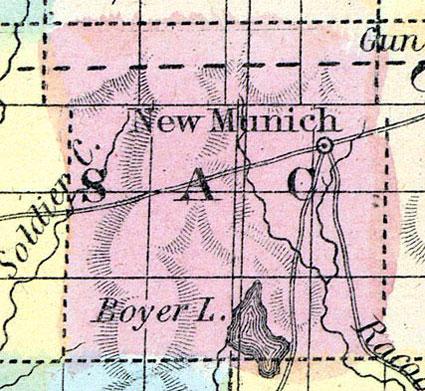
SAC COUNTY Was organized in 1858, and lies in the fourth tier of counties from the northern line of the State, and the third east of the Missouri River. It is bounded on the north by Buena Vista County, on the east by Calhoun, on the south by/Carroll and Crawford, and on the west by Ida. It contains five hundred and seventy-six square miles, being twenty-four miles square. North Raccoon River flows through the eastern townships of the county, and the western townships are well watered by numerous small streams, comprising the head waters of the Boyer River, and some of the tributaries of Maple River.
Land in the western part of the county is of the best quality. The northern tier of townships is on an average only eight miles from the surveyed route of the DuBuque and Sioux City Railroad, and the Cedar Rapids and Missouri River Railroad is located near the southern townships.
SAC CITY is the county seat, situated on Raccoon River, seventy-five miles northwest of Boonsboro. It contains two churches, Baptist and Methodist, and a Lodge of Masons: also three general stores. Population 100.
GRANT CITY is in the southeastern part of the county, on the North Raccoon River. and on the stage route from Fort Dodge to Council Bluffs. It has three churches, Baptist, Methodist Episcopal, and Methodist Protestant; also one flour and saw mill, and one general store. There are about 8,000 acres of good timber land in the township, and the remainder is well watered prairie with soil of a black sandy loam.
SOUTHPORT is another post office in the county. (Hair's Iowa State Gazetteer..., 1865)
Annotations
Total Population 1860
246
Free Black Population 1860
0
Presidential Election Result 1856
Democrat
Presidential Election Result 1860
Democrat
Presidential Election Result 1864
Unconditional Union (1864)
Latitude
42.387526
Longitude
-95.105224
Type
County
County
Sac
State
Iowa

