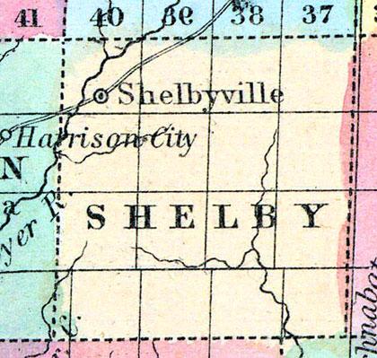
SHELBY, a new county in the W. part of Iowa, contains about 550 square miles. The Boyer river, an affluent of the Missouri, flows through the county in a S. W. direction. It is not yet organized, and has few inhabitants. (Baldwin's New and Complete Gazetteer of the United States..., 1854)
SHELBY COUNTY Was organized in 1853, and is in the fourth tier of counties from the southern line of the State, and the second east of the Missouri River. It is bounded on the north by Crawford, on the east by Audubon, on the south by Cass and Pottawattamie, and on the west by Harrison. It is watered principally by the West Nishnabotany and its tributaries, which, with many never-failing springs, give it the character of a well-watered county.
It is principally prairie, which is generally high and rolling, sometimes approaching to bluffs near the streams. It has a fair proportion of good timber in the central and southern parts, along the streams, but the northern part is destitute of timber, excepting in the northwest corner, which contains about fifteen square miles of good timber. There is some water power on the streams.
HARLAN, a small post village in the centre of the county, on the Nishnabotany River, is the county seat.
Botany, Manteno, and Shelbyville, are the other post offices and villages of the county. (Hair's Iowa State Gazetteer..., 1865)

