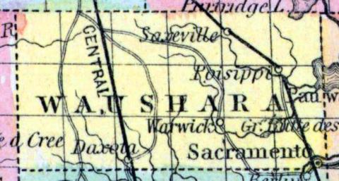
WAUSHARA, a oounty in the central part of Wisconsin, contains about 650 square miles. It is. drained by the Neenah, White, and Pine rivers. Organized in 1852. Capital, Sacramento. (Baldwin's New and Complete Gazetteer of the United States..., 1854)
WAUSHARA, County, is bounded on the north by Portage and Waupacoa, east by Winnebago, south by Marquette, and west by Adams, and is 18 miles north and south by 36 miles east and west. It was established February 15, 1851, from Marquette, remaining in judicial connection therewith, until February 16, 1852, when it was completely organized. The seat of justice is at Sacramento, in the southeast comer of the county, on Fox river. This county embraces what has been familiarly known recently as the "Indian Lands" of Marquette county. It belongs to the third judicial circuit. County Officers for 1853 and 1854: Sheriff, Nathaniel Boyington; Clerk of Court, Allyn Boardman; District Attorney, C. M. Seely; Register, James S. Bugh; Clerk of Board of Supervisors, Augustus P. Noyes; Treasurer, Charles N. Shumway; Surveyor, S. W. Hall; Coroner, George Marshall. (John Warren Hunt, Wisconsin Gazetteer..., Madison, 1853)

