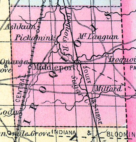
IROQUOIS COUNTY, situated on the east boundary of Illinois, and traversed by the Iroquois river. Area, 1,428 square miles. Seat of justice, Middleport. Pop. in 1840, 1,695; in 1850, 4,149. (Fanning's, 1853)
IROQUOIS, a county in the E. part of Illinois, bordering on Indiana, has an area of 1436 square miles. It is drained by the Kankakee and Iroquois rivers, which unite in the N. part of the county. The surface is level and low, and principally prairie; the soil is fertile, adapted to grain and grass. In 1850 the county produced 311,115 bushels of Indian corn; 27,125 of wheat: 69,793 of oats, and 1496 tons of hay. It contained 1 church. The Chicago branch of the Central railroad passes through this county. Capital, Middlesport. Population, 4149. (Baldwin's New and Complete Gazetteer of the United States..., 1854)
IROQUOIS County Is situated in the east part of the state, bordering on Indiana, and has an area of 1,435 square miles. It is drained by the Kankakee and Iroquois rivers, which unite in the north part of the county. The surface is level, and consists principally of prairie land. The soil is fertile, and well adapted to grain and grass. The county is intersected by the Chicago branch of the Illinois Central railroad.
Two other lines are proposed, which, when completed, will pass through this county, viz.: The Wabash Valley, and the eastern extension of the Peoria and Oquawka railroads.
It contains several churches, and has a liberal number of pupils attending public schools. Two newspapers are also published in the county. Capital, Middleport. Population, about 8,000. (Hawes' Illinois State Gazetteer...,1859)

