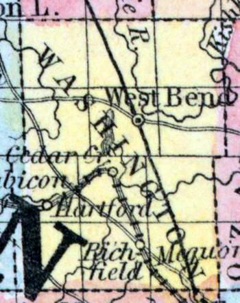
WASHINGTON COUNTY, situated on the east boundary of Wisconsin, with Lake Michigan on the east. Area, ------ square miles. Seat of justice, Ozaukee. Pop. in 1840, 343; in 1850, 19,465. (Fanning's, 1853)
WASHINGTON, a county in the E. S. E. part of Wisconsin, has an area of about 430 square miles. It is intersected by Milwaukee river, and also drained by Ossin and Rubicon rivers, small affluents of Rock river, and by Cedar and Sauk creeks. The surface is undulating or nearly level; the soil is based on limestone, and is very productive. Previous to the settlement, which commenced in 1836, the county was covered with dense forests. Wheat, Indian corn, oats, potatoes, hay, butter, cattle, and swine are the staples. In 1850 this county produced 123,806 bushels of wheat; 102,859 of oats: 34,524 of corn: 10,078 of barley; 123,252 of potatoes; 3261 tons of hay, and 171,822 pounds of butter. It contained 11 churches, 1 newspaper office, and 1748 pupils attending public schools. The limestone which underlies the surface is a good material for building. A mine of iron ore has been opened in the township of Hartford. The county is copiously supplied with water-power. Public Works: Milwaukee and Fond du Lac railroad. In 1850 the population of the county was 19,485, but since that time the limits have been reduced by the formation of Ozaukee county. Capital, West Bend. (Baldwin's New and Complete Gazetteer of the United States..., 1854)
WASHINGTON, County, is bounded on the north by Fond du Lac and Sheboygan, on the east by the State line in Lake Michigan, on the south by Milwaukee and Waukesha, and on the west by Dodge. It was set off from Milwaukee December 7, 1836, was organized for county purposes August 30, 1840, and fully established February 20, 1845. By an act of the legislature, approved in 1853, the portion of the county east of range 20, was set off and organized into a new county, by the name of Ozaukee, and the county seat of the new county was fixed at Ozaukee, (Port Washington), and that of Washington county, at West Bend, near the centre of the county. The surface is rolling, and abounds in living springs and streams of water, and is heavily timbered with oak, beech, maple, ash, &c. A large majority of the farmers are hardy Germans, who cultivate thoroughly. Wheat has been a surer crop for the last few years in this than in any other county in the State. The soil is well adapted to the raising of the grape and to tillage. The county is connected with the third judicial circuit, and with the third congressional district, and its legislative representation is as follows: The towns of Mequon, Cedarburg, Grafton, Port Washington, Saukville, Fredonia and Belgium, constitute the third senate district. The towns of Erin, Richfield, Germantown, Jackson, Polk, Hartford, Addison, West Bend, Newark, Trenton, Farmington, Kewaskum and Wayne, constitute the fourth senate district. First assembly district, towns of Belgium, Fredonia, Saukville, and Port Washington. Second assembly district, towns of Cedarburg, Grafton and Mequon. Third assembly district, towns of Erin, Richfield, Polk, Jackson, and Germantown. Fourth assembly district, Hartford, Addison, Wayne, Kewaskum, Newark, West Bend, Trenton and Farmington. The principal streams are the Milwaukee river and Oconomowoc creek. Population in 1838, 64; 1840, 343; 1842, 965; 1846, 7,473; 1847, 15,447; 1850, 19,476. There are 1,636 farms, 381 buildings, and 7 manufactories. (John Warren Hunt, Wisconsin Gazetteer..., Madison, 1853)

