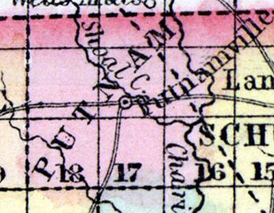
PUTNAM COUNTY, situated on the north boundary of Missouri, with Chariton river on the east. Area, --------- square miles. Seat of justice, Putnamville. Pop. in 1850, 1,657. (Fanning's, 1853)
PUTNAM COUNTY, A new county in the N. part of Missouri, bordering on Iowa, has an area of about 290 square miles. It is bounded on the E. by Chariton River, flowing from N. to S., and intersected by Shoal Creek. The surface is diversified with prairies and woodlands. Indian corn, wheat, oats, grass, cattle, and butter are the staples. In 1850 the county produced 49,940 bushels of corn; 680 of wheat ; 2020 of oats, and 9843 pounds of butter. There were 200 pupils attending public schools. Capital, Putnamville. Population, 1636, of whom 1617 were free, and 19 slaves. (Baldwin & Thomas, A New and Complete Gazetteer of the United States ..., 1854)

