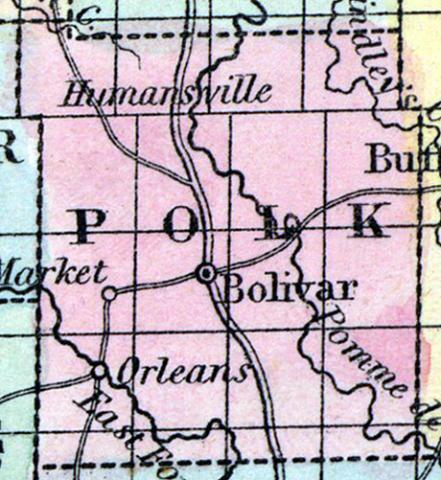
POLK COUNTY, situated in the southwesterly part of Missouri. Area, 760 square miles. Seat of justice, Bolivar. Pop. in 1840, 8,449; in 1850, 6,186. (Fanning's, 1853)
POLK, a county in the S. W. central part of Missouri, has an area of 625 square miles. It is traversed from S. to N. by Pomme de Terre river, intersected in the S. W. part by the East fork of Sac river, and also drained by Lindley's creek. The general surface is undulating or level, and is diversified by prairies and forests. The soil is fertile, and abounds with springs of limestone water. Indian corn, wheat, oats, butter, cattle, and swine are the staples. In 1850 the county produced 308,000 bushels of corn; 14,860 of wheat; 104,925 of oats, and 60,212 pounds of butter. It contained 11 churches, and 864 pupils attending public schools. Iron and lead abound in it. The rivers and creeks afford extensive water-power. Capital, Bolivar, Population, 6186; of whom 6817 were free, and 369, slaves. (Baldwin & Thomas, A New and Complete Gazetteer of the United States ... 1854)

