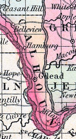
CALHOUN COUNTY, situated on the westerly boundary of Illinois, between Illinois and Mississippi rivers. Area, 240 square miles, containing a rich table land 37 miles long, and from 3 to 10 miles wide. Seat of justice, Gilead. Pop., in 1830, 1,092; in 1840, 1,741; in 1850, 3,231. (Fanning's, 1853)
CALHOUN COUNTY Is situated in the west part of the state, bordering on Missouri, and has an area of 260 square miles. It occupies a narrow strip of land between the Mississippi and Illinois rivers, which unite at the south-east extremity of the county. The surface is broken by bluffs and ravines, and is partly subject to inundations. The river bottoms produce good pasture for cattle. Pork and beef are extensively exported from this county. On the banks of the Mississippi stone and coal are very abundant. Capital, Hardin. Population, 4260. (Hawes' Illinois State Gazetteer...,1859)

