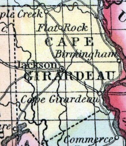
CAPE GIRARDEAU COUNTY, situated In the southeast part of Missouri, on the westerly side of Mississippi river. Area, 864 square miles. The face of the country is generally level, a part of which is subject to annual inundation. Soil fertile. Seat of justice, Jackson. Pop in 1820, 5,968; in 1830, 7,430; in 1840, 9,359; in 1850; 13,912. (Fanning's, 1853)
CAPE GIRARDEAU, a county in the E. S. E. part of Missouri, bordering on the Mississippi river, has an area of 875 square miles. It is drained by the head streams of the Whitewater, an affluent of St. Francis river, and by Apple creek: the Mississippi forms its E. boundary, and separates it from Illinois. The surface is nearly level; the soil is rich, and extensively cultivated. Indian corn, wheat, oats, hay, tobacco, cattle, and swine are the staples. In 1850 this county produced 510,730 bushels of corn; 62,040 of wheat; 65,677 of oats, and 608 tons of hay. It contained 9 churches and 2 newspaper offices, 54 pupils attending public schools, and 160 attending academies or other schools. The county is plentifully supplied with good timber, including the cypress. It was settled in 1794 by French and Germans. Capital, Jackson. Population. 13,912, of whom 12,238 were free, and 1674, slaves. (Baldwin & Thomas, A New and Complete Gazetteer of the United States ... 1854)

