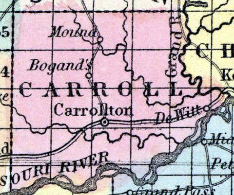
CARROLL COUNTY, situated toward the westerly part of Missouri, on the north side of the Missouri river. Area, 700 square miles. Seat of justice, Carrollton. Pop. in 1840, 2,423; in 1850, 5,441. (Fanning's, 1853)
CARROLL, a county in the N. W. central part of Missouri, has an area of 700 square miles. The Missouri river, navigable by steamboats, forms its boundary on the W., and Grand river on the E. ; the county is also drained by Wyaconda and Big creeks. The surface in some parts is undulating, and presents extensive prairies alternating with forests of oak, black walnut, sugar-maple, and hickory. The soil is generally productive. Indian corn, wheat, oats, tobacco, cattle, horses, and swine are the staples. In 1850 this county produced 311,675 bushels of corn; 26,452 of wheat; 34,055 of oats, and 289,869 pounds of tobacco. It contained 9 churches, 321 pupils attending public schools, and 43 attending an academy. Limestone and sandstone are abundant in the county. The streams furnish valuable water-power. Capital, Carrollton. Population, 5441, of whom 4820 were free, and 621, slaves. (Baldwin & Thomas, A New and Complete Gazetteer of the United States ... 1854)

