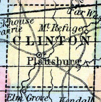
CLINTON COUNTY, situated toward the northwestern part of Missouri. Area, 425 square miles. Soil fertile, and generally prairie. Seat of justice, Plattsburgh. Pop. in 1836, 1,890; in 1840, 2,724; in 1850, 3,786. (Fanning's, 1853)
CLINTON, a county in the N. W. part of Missouri, has an area of 460 square miles. It is drained by Smith's fork and Little Platte river, and by Castile creek. The general surface is nearly level, and the soil productive. The county has a large proportion of prairie. The timber consists of hickory, elm, black walnut, and many kinds of oak. Indian corn, wheat, oats, hemp, cattle, and pork are the staples. In 1860 this county produced 299,070 bushels of corn; 22,363 of wheat; 48,469 of oats, and 193 tons of hemp. Limestone and sandstone are the principal rocks of the county. The projected railroad from Hannibal to St. Joseph will probably pass through the county. Capital, Plattsburg. Population, 3786, of whom 3347 were free, and 439, slaves. (Baldwin & Thomas, A New and Complete Gazetteer of the United States ... 1854)

