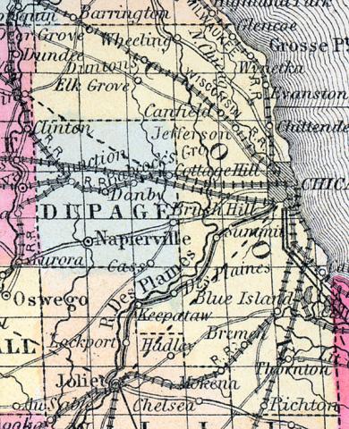
COOK COUNTY, situated on the easterly boundary of Illinois, on the west side of Lake Michigan, and watered by Des Plaines, Chicago, and Du Page rivers. Area, 864 square miles. Face of the country generally level, containing prairies; soil fertile. Seat of justice, Chicago. Pop. in 1835, 7,500; in 1840, 10,201; in 1850, 43,385. (Fanning's, 1853)
COOK COUNTY Is situated in the north-east part of Illinois, bordering on Indiana and Lake Michigan, and has an area of 1,027 square miles. It is intersected by the Des Plaines, Calumet and Chicago rivers. Lake Michigan washes the eastern border. The surface is slightly undulating. Its prairies are large and fertile, and are interspersed with fine groves of timber. Its soil is deep and highly productive. In 1860 the quantity of oats, hay and butter produced by this county exceeded those of any other in the state. The county is intersected by the various lines of railroad leading out from its capital, making access to all parts easy, and increasing its value to an almost incredible extent. Organized in 1831, and named in honor of Daniel P. Cook, a member of congress from the state, who obtained from government a grant of 300,000 acres of land in aid of the Illinois and Michigan canal. Capital, Chicago. Population, about 220,000. County Judge, Wm. T. Barron. Sheriff, John L. Wilson. (Hawes' Illinois State Gazetteer...,1859)

