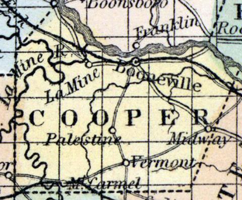
COOPER COUNTY, situated in the central part of Missouri, on the south side of Missouri river. Area, 400 square miles. Face of the country generally level, with rich and fertile prairies. The alluvial soil along the streams is also of first rate quality. Seat of justice, Bonneville. Pop. in 1820, 6,959; in 1830, 6,019; in 1840, 10,848; in 1850, 12,950. (Fanning's, 1853)
COOPER, a county in the central part of Missouri, has an area of 558 square miles. It is bounded on the N. by the Missouri river, intersected in the N. W. part by Lamine river, and also drained by Little Saline and Moniteau creeks. The surface is generally undulating and hilly, consisting of prairies and timbered land in convenient proportions: the soil is highly productive and easily cultivated. Indian corn, wheat, oats, hay, tobacco, hemp, cattle, and swine are the staples. The grape is extensively cultivated, and will in a few years be an important article of export. In 1850, the county produced 997,870 bushels of corn; 92,666 of wheat; 123,840 of oats; 3800 tons of hay; 127,800 pounds of tobacco, and 171,879 pounds of butter. It contained 9 churches: 460 pupils attending public schools, and 268 attending academies and other schools. The mineral resources of the county are said to be inexhaustible. Cannel and bituminous coal of good quality are found throughout the county; it also contains rich mines of iron and lend near Lamine river; marble and hydraulic limestone are found in several localities; and a rare description of sand, used in the manufacture of flint glass, is abundant on Moniteau creek. Lamine river is navigable from its mouth to the entrance of Blackwater river. Named in honor of Colonel Cooper, an early settler of the county, and a native of Tennessee. Capital, Boonville. Population, 12,950, of whom 9859 were free, and 3091, slaves. (Baldwin's New and Complete Gazetteer of the United States..., 1854)

