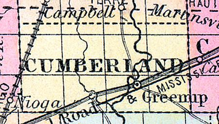
CUMBERLAND COUNTY, situated near the easterly part of Illinois. Area, ----- square miles. Seat of justice, Greenup. Pop. in 1850, 3,720. (Fanning's, 1853)
CUMBERLAND a county in the E. S. E. part of Illinois, has an area of 310 square miles. It is intersected by the Embarras river, an affluent of the Wabash. The surface is diversified with prairies and tracts of timber; the soil is good. Indian corn, wheat, oats, and pork are the staples. In 1850 the county produced 217,015 bushels of corn; 5122 of wheat, and 33,906 of oats. It contained 2 churches, and 425 pupils attending public schools. The National road passes through the county. The Mississippi and Atlantic railroad, when finished, will connect it with St. Louis and Terre Haute, in Indiana. Capital, Greenup. Population, 3720. (Baldwin's New and Complete Gazetteer of the United States..., 1854)

