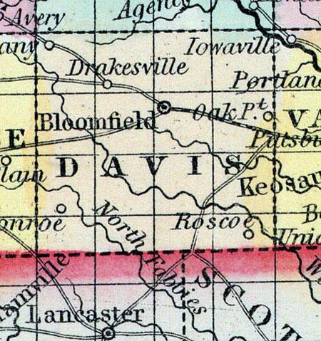
DAVIS, a county in the S. S. E. of Iowa, bordering on Missouri, has an area of 480 square miles. It is intersected by Fox river and Soap creek, and drained also by the sources of the Wyaconda and Fabius rivers, which flow south-eastward. The surface is rolling, the soil rich and well watered, but mostly destitute of timber. Indian corn, butter, and wool are the staples. In 1850 this county produced 431,207 bushels of Indian corn: 60,168 of oats; 17,445 pounds of wool, and 80,385 of butter. The population is increasing rapidly. Named in honor of Garrett Davis, former member of Congress from Kentucky. Capital, Bloomfield. Population, 7264. (Baldwin's New and Complete Gazetteer of the United States..., 1854)
DAVIS COUNTY Is the second county from the Mississippi, on the Missouri State line, and is settled to a great extent by immigrants from Missouri and Illinois. The principal streams watering the county are the north and south branches of the Waukindau, and the Fox River, which, with several - smaller streams, have their rise in the county, passing through Missouri to the Mississippi. The Des Moines River runs diagonally across the north-east corner of the county, several of whose tributaries traverse the county. The principal towns in Davis County are Bloomfield.(the county-seat,) Troy, Drakesville, Nottingham, and Mount Calvary, and small settlements, the post-offices of which are named Oak Spring, Soap Creek, Salt Creek, Pleasant View, Taylor, Troy, Dover, Pulaski, Stringtown, Monterey, Savannah, Roscoe, and Del Norte. There are 14,320 acres of unentered land in Davis County. For a description of the soil see Monroe — the soil in the two counties being similar. (Parker's Iowa as it is in 1855..., 1855)

