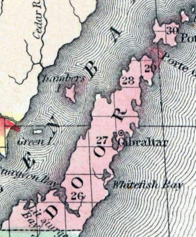
DOOR COUNTY, Wisconsin, is a narrow peninsula between Lake Michigan and Green bay, forming the N. E. extremity of the state. The area is about 400 square miles. It was separated from Brown county in 1850, but is not yet organized. Capital, Gibraltar. (Baldwin's New and Complete Gazetteer of the United States..., 1854)
DOOR, County, is located between Green Bay and Lake Michigan, and is bounded on tbe north and east by the State line of Michigan, on the south by Kewaunee, and on the west by Oconto. It was set off from Brown, February 11, 1851. It then included the present county of Kewaunee, and was attached to Manitowoc for judicial government. The county seat was established at Gibralter, on Gibralter Bay, heretofore known as Bailey's Harbor, on the west shore of Lake Michigan, in town 30 N., of range 28 E. Door county is for legislative and county purposes, in connection with Brown county. It has several small streams emptying into the Bay and into Lake Superior. (John Warren Hunt, Wisconsin Gazetteer..., Madison, 1853)
Founded in 1851 from parts of Brown county.

