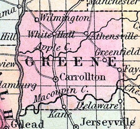
GREENE COUNTY, situated toward the westerly part of Illinois, with Illinois river on the west. Area, 942 square miles. Face of the country rolling; soil, fertile. Seat of justice, Carrollton. Pop. in 1830, 7,674; in 1840, 11,951; in 1850, 3,658. (Fanning's, 1853)
GREENE COUNTY Is situated in the west-south-west part of the state, and has an area of 500 square miles. The Illinois river, navigable by steamboats, forms its entire boundary on the west and Macoupin creek on the south. It is drained by Apple creek. The surface is undulating, and the soil highly productive and well cultivated. The county contains a large proportion of timbered land and several beautiful upland prairies of small extent. Corn, wheat, oats, hay, potatoes and pork are the staples. Fruit is also cultivated to a considerable extent. It contains about forty churches and several newspaper offices. Coal is also found in the county in abundance. The county is intersected by the Jacksonville and Carrollton railroad, which is being built. Capital, Carrollton. Population, about 14,500. County Judge, C. D. Hodges.
Sheriff, L. J. Patterson. (Hawes' Illinois State Gazetteer...,1859)

