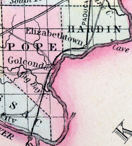
HARDIN COUNTY, situated in the southeastern part of Illinois, bounded on the east and south by Ohio river. Area, 100 square miles. Seat of justice, Elizabethtown. Pop. in 1840, 1,378; in 1850, 2,887. (Fanning's, 1853)
HARDIN, a county in the S. part of Illinois, bordering on Kentucky, is one of the smallest counties in the state, having an area of 260 square miles. The Ohio river forms the S. boundary. The soil is productive. Indian corn, oats, cattle, and swine are the staples. In 1850 this county produced 164,400 bushels of corn; 6311 of oats, and 6644 pounds of butter. It contained 7 churches, and 375 pupils attending public schools. The Cave in Rock, well known to the navigators of the Ohio, is situated in this county. Hardin was formed recently out of part of Pope county. Capital, Elizabethtown. Population, 2887. (Baldwin's New and Complete Gazetteer of the United States..., 1854)
HARDIN COUNTY Is situated in the south part of the state, bordering on Kentucky, and is one of the smallest counties in the state, having an area of only 260 square miles; the Ohio river forms the southern boundary, the soil is productive. Corn, oats, cattle and swine, are the staples; it contains some 15 or 20 churches, and has over 800 pupils attending public schools; the Cave-in-rock well, known to navigators on the Ohio river, is situated in this country. Hardin once formed a part of Pope county. Capital, Elizabethtown. Population, about 4,000. (Hawes' Illinois State Gazetteer...,1859)

