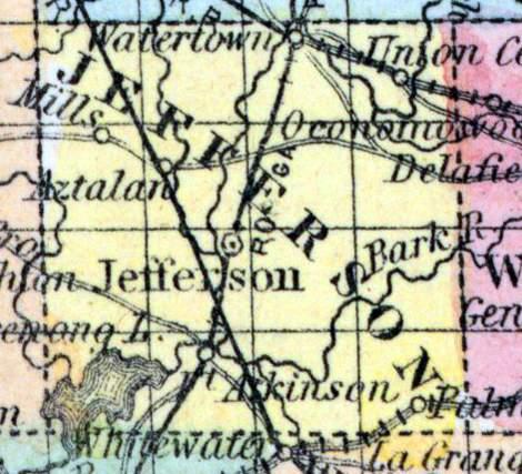
JEFFERSON COUNTY, situated toward the southeast part of Wisconsin, and traversed by Rock river. Area, 576 square miles. Seat of justice, Jefferson. Pop. in 1840, 914; in 1850, 6 955. (Fanning's, 1853)
JEFFERSON, a county in the S. E. part of Wisconsin, has an area of about 600 square miles. It is intersected by Hock river, which flows south-westward, and also drained by Crawfish and Bark rivers, affluents of the former. Koshkonong lake, an expansion of Hock river, in the S. W. part of the county, is about 8 miles long and several miles wide. The surface is undulating, and in some parts nearly level. The eastern part is covered with dense forests of large trees; the remainder produces a sparse growth of oak and hickory. The soil is generally good, and the valley of Rock river is noted for fertility. Wheat, Indian corn, oats, potatoes, hay, and pork are the staples. In 1850 this county produced 182,545 bushels of wheat; 81,079 of Indian corn; 117,894 of oats; 60,922 of potatoes; 14,290 tons of hay, and 190,820 pounds of butter. It contained 12 churches, 2 newspaper offices, 3219 pupils attending public schools, and 60 attending academies and other schools. The rock which underlies the county is blue limestone. The rivers furnish abundant water-power, which is partly improved. The county is intersected by the Milwaukee and Mississippi railroad, and by a plank-road leading to Lake Michigan. Capital, Jefferson. Population, 15,317. (Baldwin's New and Complete Gazetteer of the United States..., 1854)
JEFFERSON, County, is bounded on the north by Dodge, east by Waukesha, south by Walworth and Rock, and west by Dane, and is four townships square, containing 576 sections. It was set off December 7, 1836, and established from Milwaukee, to which it remained attached until 29th February, 1839, when it was completely organized. The county seat is at the village of Jefferson, opposite the forks of the Crawfish with Rock river, and near the centre of the county. Its streams, are, Rock, Crawfish, and Bark river, and Johnson's, Scupernong, Whitewater, Waterloo, Duck, and Battle creek. The northeastern portion of the county is covered by the best growth of hard timber in the State, the southeast by prairie, and the remainder by openings. The surface of the western portion of the county is level or gently undulating. The excellent farming land, being well watered and timbered, together with its location and enterprizing inhabitants, entitle it to a position among the best counties in the State. The county of Jefferson constitutes the fifteenth senate district, and is divided into three assembly districts, viz.: 1. The town of Watertown. 2. The town of Waterloo, Milford, Lake Mills, and Oakland. 3. Jefferson and Koskonong. 4. Ixonia, Concord, Farmington and Aztalan. 5. Hebron, Sullivan, Coldspring and Palmyra. It is connected with the second judicial circuit, and the third congressional district. The population in 1838 was 468; 1840,914; 1842,1,638; 1846,8,680; 1847, 11,464; 1850, 15,339. Dwellings, 2,933; manufactories, 25; farms, 1,042. (John Warren Hunt, Wisconsin Gazetteer..., Madison, 1853)

