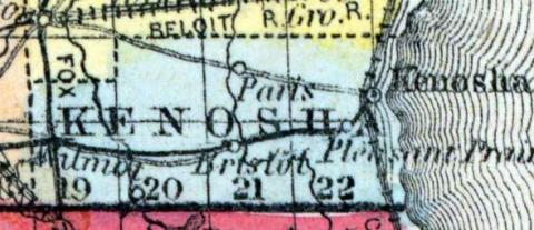
KENOSHA COUNTY, situated at the southeast corner of Wisconsin, on Lake Michigan. Area, -------- square miles. Seat of justice, Kenozha. Pop. in 1850, 10,734. (Fanning's, 1853)
KENOSHA, a county, forming the S. E. extremity of Wisconsin, bordering on Lake Michigan and Illinois, contains 276 square miles. It is drained by the Pishtaka and Des Plaines rivers. The surface is nearly level, and mostly destitute of timber, excepting scattered groves of oak and hickory. The soil is calcareous and fertile. Wheat, Indian corn, oats, and potatoes are the chief products. In 1850 the county produced 318,051 bushels of wheat; 100,046 of corn; 230,969 of oats; 68,555 of potatoes; 284,793 pounds of butter, and 24,229 tons of hay. It contained 12 churches, 2 newspaper offices, 2980 pupils attending public schools, and 80 attending academies or other schools. The rock which underlies the county is limestone. A plank-road extends through the county from the lake to Pishtaka river. Kenosha county was formed in 1850, from the S. part of Racine. Capital, Kenosha. Pop., 10,734. (Baldwin's New and Complete Gazetteer of the United States..., 1854)
KENOSHA, County, is bounded on the north by Racine, east by Lake Michigan, south by the State of Illinois, and west by Walworth and a portion of Racine. The county seat is at Kenosha, formerly known as Southport, on the lake shore, about midway between the northern and southern extremity of the county. It was set off from Racine and fully organized, 30th January, 1850. The eastern portion of the county is mostly prairie, with occasional groves of timber. In the northeast part is a large tract of heavy timber. The western portion is mostly openings. The soil is productive in the highest degree, and well adapted to the growing of all the crops of the climate, and the raising of stock. It has the best of market facilities—Kenosha close at hand, and Milwaukee and Chicago easy of access. It has a healthy climate, and is settled by an intelligent and enterprizing class of farmers. The principal streams are the Fox, (Pishtaka,) the Aux Raines and Pike creeks. Population 10,734; 927 farms, and 1,812 dwellings. This county belongs to the first congressional district, the first judicial circuit, and forms the eighth senate district, sending two members to the assembly as follows: 1. City of Kenosha and towns of Southport, Somers, and Pleasant Prairie; 2. Towns of Paris, Bristol, Brighton, Salem and Wheatland. County Officers for 1853 and 1854: County Judge, Hon. Isaac N. Stoddard; 2. Sheriff, Patrick Cosgrave ; Clerk of Court, Oscar F. Dana ; Register of Deeds, Samuel T. Brande; County Treasurer, Michael Frank; District Attorney, Isaac W. Webster; County Surveyor, M. Howland; Clerk of Board of Supervisors, R. H. Deming; Coroner, Philip Carey. (John Warren Hunt, Wisconsin Gazeteer..., Madison, 1853)

