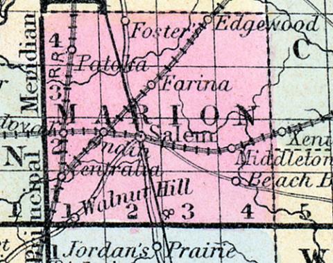
MARION COUNTY, situated toward the south part of Illinois. Area, 576 square miles. Seat of justice, Salem. Pop. in 1830, 2,125; in 1840, 4,742; in 1850, 6,720. (Fanning's, 1853)
MARION, a county in the S. central part of Illinois, has an area of 580 square miles. It is drained by the Skillett fork of Little Wabash river, andby Crooked and other creeks. The county includes a part of the Grand Prairie, and is partly covered with forests. The general surface is undulating; the soil is excellent. Indian corn, wheat, oats, potatoes, castor beans, white beans, and fine fruits flourish, and the prairies produce excellent pasturage for cattle. In 1850 there were raised 413,335 bushels of corn; 5813 of wheat; 71,557 of oats, and 1553 tons of hay. It contained 9 churches, and 668 pupils attending public schools. The surveyed routes of the Central railroad and of the Ohio and Mississippi railroad intersect each other in this county. Capital, Salem. Pop., 6720. (Baldwin's New and Complete Gazetteer of the United States..., 1854)
MARVIN(sic) COUNTY Is situated in the south central part of the state, and has an area of 530 square miles. It is drained by the Skillet fork of Little Wabash river, and by Crooked and other creeks. The county includes a portion of the Grand Prairie, and is partly covered with forest. The general surface is undulating; the soil excellent. Corn, wheat, oats, potatoes and fine fruit nourish, and the prairies afford excellent pasturing for cattle. Castor beans are cultivated to some considerable extent. It contains several churches, and has over 1,000 pupils attending public schools. Both the main line and the Chicago branch of the Illinois Central railroad, and also the Ohio and Mississippi railroad traverse the county. Capital, Salem. Population, about 9,000. (Hawes' Illinois State Gazetteer...,1859)

