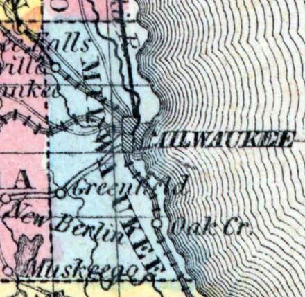
MILWAUKEE COUNTY, situated on the east boundary of Wisconsin, on Lake Michigan, and traversed by river. Area, ---------- square miles. Seat of justice, Milwaukee. Pop. in 1840, 5,605; in 1850, 31,010. (Fanning's, 1853)
MILWAUKEE, a county in the S. E. part of Wisconsin, bordering on Lake Michigan, contains 240 square miles. It is drained by the Milwaukee, Menomonee, and Root rivers. The surface is gently undulating. The soil is calcareous, and highly productive. The staples are wheat, corn, oats, potatoes, hay, and butter. In 1860 the county produced 61,147 bushels of wheat; 125,584 of oats: 11,246 tons of hay, and 158,521 pounds of butter. It contained 32 churches, 17 newspaper offices, 4857 pupils attending public schools, and 1506 attending academies and other schools. The streams furnish water-power for numerous mills and factories. Milwaukee county is traversed by 6 plank-roads, and by the Milwaukee and Mississippi railroad. Settled in 1834 or '35. Though the smallest in extent, it is the most populous county in the state, and the most important, as containing the city of Milwaukee, the commercial capital of Wisconsin. Population, 31,077. (Baldwin's New and Complete Gazetteer of the United States..., 1854)
MILWAUKEE, County, is bounded on the north by "Washington, east by the State line, south by Racine, and west by Waukesha. It was established and set off from Brown, Sept. 6, 1834, and fully organized. Its original limits extended from the south and east lines of the present State of Wisconsin north to the north line of township 12, and west to the line between the Green Bay and Wisconsin land districts, which was established June 26,1834, and was "a north and south line drawn from the northern boundary of Illinois, along the range line next west of Fort Winnebago to the Wisconsin river," or the range line between ranges 8 and 9 E. The seat of justice is established at the city of Milwaukee. This county was originally covered with a heavy growth of hard timber. The soil is good and well adapted to the raising of grain and to gardening. The streams are the Milwaukee, Menomonee, and Root rivers and Oak creek. This county is in the second judicial circuit and the first congressional district. Its legislative representation is as follows: The first and second wards of the city of Milwaukee, and towns of Wauwatosa, Milwaukee and Granville, constitute the fifth senate district. The third, fourth, and fifth wards in the city of Milwaukee, and the towns of Greenfield, Lake, Oak Creek and Franklin, constitute the sixth senate district. The first ward in the city of Milwaukee constitutes an assembly district. The second ward in the city of Milwaukee constitutes an assembly district. The third ward in the city of Milwaukee constitutes an assembly district. The fourth ward in the city of Milwaukee constitutes an assembly district. The fifth ward in the city of Milwaukee constitutes an assembly district. The towns of Franklin and Oak Creek constitute an assembly district. The towns of Greenfield and Lake constitute an assembly district. The town of Wauwatosa constitutes an assembly district. The towns of Milwaukee and Granville constitute an assembly district. County Officers for the years 1853 and 1854: Judge, Horatio N. Wells; Sheriff, Herman L. Page; Clerk of Court, Matthew Keenan; District Attorney, A. R. R. Butler; Register of Deeds, Charles J. Kern. (John Warren Hunt, Wisconsin Gazetteer..., Madison, 1853)

