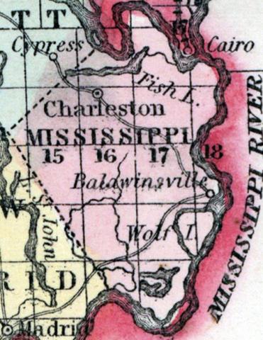
MISSISSIPPI COUNTY, situated on the southeasterly part of Missouri, with Mississippi river on the east. Area, ---------- square miles. Seat of justice, Charleston. Pop. in 1850, 3,123. (Fanning's, 1853)
MISSISSIPPI, a county in the S. E. part of Missouri, bordering on the river of its own name, opposite the mouth of the Ohio, has an area of 400 square miles. The Mississippi river separates it from Kentucky and Illinois, and forms its boundary on the N., E., and S. The county is drained by James and Cypress bayous. The surface is level; the soil is very fertile, particularly adapted to Indian corn, which is the staple production. In 1850 there were raised in the county 354,700 bushels of corn; 3727 of wheat; 95 tons of hay, and 22,955 pounds of butter. It contained 4 churches, and 190 pupils attending public schools. A portion of tho county is occupied by cypress swamps. An appropriation has been made by the state for the purpose of reclaiming the lands in this county which were submerged by the earthquakes of 1811 and 1812. Organized in 1815. Capital, Charleston. Population, 3123, of whom 2377 were free, and 740, slaves. (Baldwin & Thomas, A New and Complete Gazetteer of the United States ... 1854)

