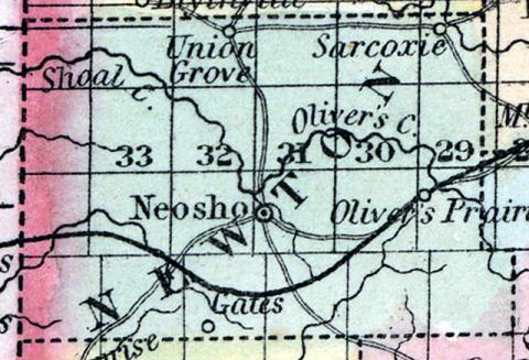
NEWTON COUNTY, situated on the west boundary of Missouri. Area (in 1840), 1,150 square miles. Seat of justice, Neosho. Pop. in 1840, 3,790; in 1850, 4,268. (Fanning's, 1853)
NEWTON, a county in the W. S. W. part of Missouri, bordering on the Indian territory, his an area of 750 square miles. It is drained by Shoal, Oliver, and Centre creeks, which flow westward, and enter the Neosho river. The soil is moderately fertile. Indian corn, wheat, oats, grass, and butter are the staples. In 1850 the county produced 196,210 bushels of corn; 18,416 of wheat; 31,318 of oats, and 43,011 pounds of butter. It contained 2 churches, and 278 pupils attending public schools. Lead mines have recently been opened 6 miles from Neosho, and are thought to be rich. Shoal creek affords abundant water-power. Capital, Neosho. Pop., 4208, of whom 4027 were free, and 241, slaves. (Baldwin & Thomas, A New and Complete Gazetteer of the United States ... 1854)

