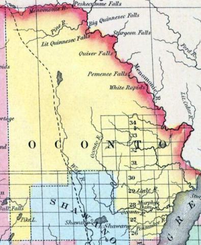
OCONTO, a county in the N. E. part of Wisconsin, bordering on Michigan and Green bay, contains about 4000 square miles. It is bounded on the N. E. by the Menomonee river, on the W. by the Wolf riv»r, and drained by the Oconto and Pishtego rivers. The surface is occupied by forests of pine. Oconto was separated from Brown county in 1850, and named from Oconto river. Capital, Jones' Mill. (Baldwin's New and Complete Gazetteer of the United States..., 1854)
OCONTO, County, is bounded on the north by the State line, on the east by the middle of Green Bay and a portion of Brown, on the south by Brown and Outagamie, and on the west by Waupacca and Marathon. It was set off and established from Brown, February 6, 1851, and organized for county purposes April 7, 1852. The principal rivers are Pishtego, Oconto, Pensaukee, and Little Suamico. The judicial connection of Oconto is with Brown, and representative with Outagamie. The chief product of this county, thus far, has been pine lumber, which is produced in great quantities; but little is known of its agricultural advantages. (John Warren Hunt, Wisconsin Gazetteer..., Madison, 1853)

