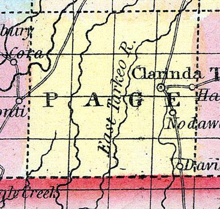
PAGE, a new county in the S. W. part of Iowa, bordering on Missouri, has an area of about 550 square miles. The Nodaway river flows through it from N. to S. The soil is good, though not extensively cultivated. Indian corn and wool are the staples. In 1850 this county produced 28,270 bushels of corn; 1998 of wheat; 2190 pounds of wool, and 197 tons of hay. County seat not located. Named in honor of Colonel Page, who was mortally wounded at Palo Alto. Population, 551. (Baldwin's New and Complete Gazetteer of the United States..., 1854)
PAGE COUNTY Is in the southern tier of [Iowa] counties, and the second east of the Missouri River, and is bounded on the north by Montgomery County, on the east by Taylor, and on the west by Fremont. The county was organized in 1851, and is twenty-four miles square. It is watered by the Nodaway River, flowing through the eastern part, the Big Tarkio, through the centre, the West Tarkio, through the western, and the East Nodaway, through the northwestern part. There are large bottom lands on each of these streams, which are mostly dry, and good farming lands. The streams in the eastern part of the county are skirted by heavy bodies of timber, principally white oak. On the west side of the county there is very little timber, and it is not so well settled as the east side. The remaining land in the county is beautifully rolling prairie, which is highly productive. There is good building stone and coal on the Nodaway River. (Hair's Iowa State Gazetteer...,1865)

