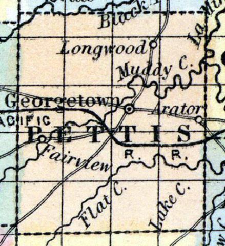
PETTIS COUNTY, situated toward the west part of Missouri. Area, 600 square miles. Seat of justice, Georgetown. Pop. in 1840, 2,930; in 1850, 5,150. (Fanning's, 1853)
PETTIS, a county in the W. central part of Missouri, has an area of 650 square miles. It is drained by the head streams of La Mine river, namely, Flat creek, Muddy creek, and Heath's fork, which unite near the N. E. border. Black river, an affluent of La Mine, flows through the N. W. part. The general surface is rolling, and presents extensive prairies, with groves of timber distributed along the large streams. The soil is fertile. Indian corn, wheat, oats, hay, butter, cattle, and pork are the staples. In 1850 the county produced 519,439 bushels of corn; 20,000 of wheat; 89,915 of oats; 1244 tons of hay, and 61,398 pounds of butter. It contained 15 churches, and 700 pupils attending public schools. Extensive beds of stone coal are found in it. Named in honor of Spencer Pettis, secretary of the State of Missouri, killed in a duel by Major Biddle. Capital, Georgetown. Population, 5150; of whom 4266 were free, and 884, slaves. (Baldwin & Thomas, A New and Complete Gazetteer of the United States ... 1854)

