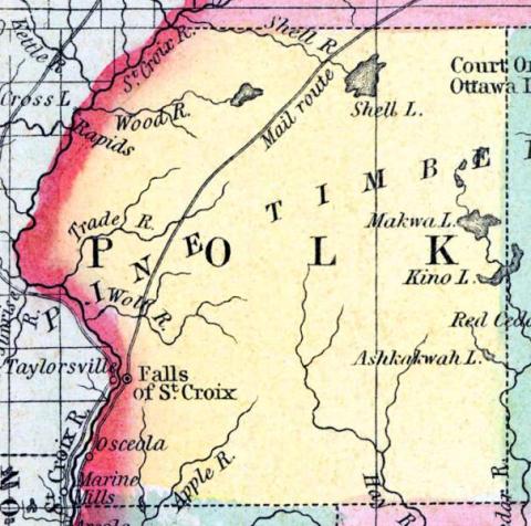
POLK, a new county in the N. W. part of Wisconsin, contains about 2500 square miles. The St. Croix river forms its entire boundary on the W., separating it from Minnesota Territory, it is also drained by Shell river. The surface is uneven, and extensively covered with forests in which the pine is found. Polk county was formed in 1853, out of the N. part of St. Croix county. Capital, St. Croix Falls. (Baldwin's New and Complete Gazetteer of the United States..., 1854)
POLK, County. By an act of the legislature approred March 14, 1853, all that portion of St. Croix county lying north of the line between township 31 and 32, was set off into a separate county, to be called and known as the county of Polk. It is therefore bounded on the north by La Pointe, on the east by Chippewa, on the south by Chippewa and St. Croix, and on the west by the Territory of Minnesota, from which it is separated by the river St. Croix. It is mostly a lumber country, though the southern part contains a large area of excellent farming lands. The village of St. Croix Falls, the county seat, situated at the head of steamboat navigation on St. Croix river, is surrounded with excellent agricultural lands, and with the business naturally centreing there of the extensive pineries above, must be a town of considerable importance. This county is to be fully organized during the present year, and will form a part of the sixth judicial circuit. The representation will continue as before the division of St. Croix. (John Warren Hunt, Wisconsin Gazetteer..., Madison, 1853)

