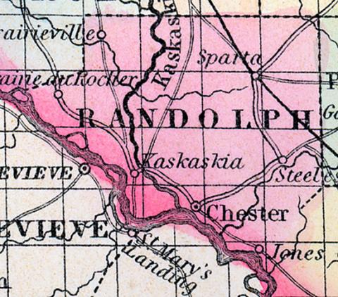
RANDOLPH COUNTY, situated on the southwesterly boundary of Illinois, with Mississippi river on the southwest, and traversed by the Kaskaskia. Area, 540 square miles. Seat of justice, Kaskaskia. Pop. in 1810, 7,275; in 1820, 3,492; in 1830, 4,436; in 1840, 7,944; in 1850, 11,079. (Fanning's, 1853)
RANDOLPH COUNTY Is situated in the south-west part of the state, bordering on Missouri, and has an area of 600 square miles. It is bounded on the southwest by the Mississippi, and intersected by the Kaskaskia river, which enters the first named stream on the southern border of the county.
The surface is undulating and hilly; the soil is fertile and well timbered. Corn, oats, wheat, cattle and swine, are the staples. It contains a large number of churches, seven) newspaper offices, and has about 2,000 pupils attending public schools. The Belleville and Murpheysboro railroad intersects this county. Fine marble is found in some parts of the county. This is among the oldest counties in the state, a trading post having been established at Kaskaskia by La Salle, in 1673. Capital, Chester. Population, about 13,500. (Hawes' Illinois State Gazetteer..., 1859)

