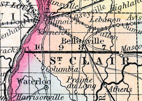
SAINT CLAIR COUNTY, situated on the southwesterly boundary of Illinois, with Mississippi river on the west, and traversed by the Kaskaskia. Area, 649 square miles. Face of the country, even; soil, generally fertile. Seat of justice, Bellville. Pop. in 1820, 5,253; in 1830, 7,078; in 1840, 13,631; in 1850, 20,181. (Fanning's, 1853)
ST. CLAIR COUNTY. A county in the south-west part of Illinois, bordering on Missouri, has an area of 630 square miles. It is situated on the Mississippi river opposite St. Louis, and intersected in the south-east part by Kaskaskia river, and in the north-west part by Cohokia creek. It is also drained by Silver and Richland creeks. The surface is undulating and in some places level, consisting partly of prairie and partly of timber land. The soil is excellent and generally cultivated. Indian corn, wheat, oats, potatoes, hay, cattle, pork and butter are the staples. Large quantities of provisions are raised in the county for the St. Louis market. It contains twenty churches and four newspaper offices. The line of the Cincinnatti and St. Louis railroad passes through the county. Coal miles are numerous and are extensively worked, particularly along the Mississippi river. A large part of the population consists of Germans. Named in honor of General Arthur St. Clair, governor of Ohio when it was a territory. Capital, Belleville. Population, about 25,000. (Hawes' Illinois State Gazetteer..., 1859)

