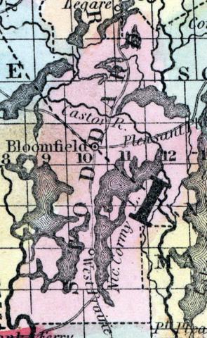
STODDARD COUNTY, situated in the southeast part of Missouri, and interspersed with numerous lakes and their connecting streams. Area, 900 square miles. Seat of justice, Bloomfield. Pop. in 1840, 3,153; in 1850, 4,277. (Fanning's, 1853)
STODDARD, a county in the S. E. part of Missouri, bordering on Arkansas, has an area of 900 square miles. It is bounded on the W. by the St. Francis river, on the E. by the Castor and Whitewater rivers. The northern part is hilly, but the greater portion of the surface is level, and extensively occupied by swamps and shallow lakes. The largest among the latter are Lake Stoddard, Lake Castor, Lake Micota, and Lake Nicormy. The last is represented by the maps to be about 25 miles long and 4 or 5 miles wide. The earthquakes of 1811 and 1812 injured this county perhaps more than any other in the state. ... The county contains extensive prairies and forests of cypress; the soil of the prairies is moderately fertile. In 1850 it produced 151,094 bushels of Indian corn; 5972 of wheat; 17,260 of oats, and 33,174 pounds of butter. It contained six churches. Capital, Bloomfield. Population, 4277, of whom 4227 were free, and 50, slaves. (Baldwin's New and Complete Gazetteer of the United States..., 1854)

